|
|
posted: August 6, 2022
tl;dr: The first of a long-running series in which I document my favorite motorcycle roads...
What makes a great motorcycle road? In my book, it is:
The ride I took last weekend from Wickenburg (elev. 2,057 feet) to Flagstaff (elev. 6,910 feet) more than satisfies all these criteria. I’ll describe it in that direction, south to north, although it is arguably more spectacular in the reverse direction because of the even more plentiful views permitted by the predominantly downhill direction. Towns/cities passed en route include Congress (elev. 3,045 feet), Yarnell (elev. 4,780 feet), Prescott (elev. 5,367 feet), Jerome (elev. 5,066 feet), Cottonwood (elev. 3,314 feet), and the world-renowned Sedona (elev. 4,350 feet). As those elevation figures might indicate, even in the south to north direction there is a descent of the spectacular kind, from the mountains above the Verde Valley down through Jerome into Cottonwood, before beginning the climb up through Sedona to Flagstaff.
Wickenburg and arguably Congress are towns on the far northwest edge of the Valley of the Sun, which in the summer means dealing with the heat. But once you start the ascent from Congress up AZ-89 to Yarnell, you will start to cool down rapidly. It’s less than 10 miles from Congress to Yarnell, but most of that is up a steep, twisty grade built into the side of a ridge of mountains, where the road’s two directions have to split and take different paths. When roads do this, it’s a sign that you’ve probably found a fun one. At the top is Yarnell and a biker-friendly café that serves breakfast and lunch: the Ranch House Restaurant. I’ve also ridden the reverse direction, from Yarnell down to Congress several times. The initial descent from the plateau where Yarnell resides creates quite an illusion: it seems as though you are about to ride off the edge of a cliff and launch yourself into the Valley of the Sun. Make sure you don’t get mesmerized and miss that first right turn.
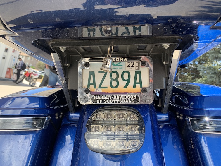
If you see the owner of this motorcycle, tell him I said hi.
There are a couple options to get from Yarnell to the biggest city on the route, Prescott (pop. 45,827). Stay on AZ-89 and you will be rewarded with plenty of fun mountain twisties that take you through pine forests above Prescott, where you’ll then descend back into civilization. Roadside crosses are a not infrequent site, so be careful to make all your turns. If you go in the summer during monsoon season, there’s a good chance that you may run into some mountain rainstorms, so be prepared. AZ-89 will take you right through the heart of old Prescott, at one time the capital of the Arizona Territory, when Phoenix was a lightly-populated agricultural outpost. You’ll ride along one side of the courthouse square at the center of town. There are plenty of bar and restaurant options here along the famed Whiskey Row, including a Harley-Davidson souvenir shop. Continue through the city along AZ-89 and then take a right onto AZ-89A by the airport.
Alternatively, if you want to skirt Prescott and avoid people as much as possible, you can take a left onto Kirkland Valley Road and then a right onto Skull Valley-Kirkland Road, which becomes Iron Springs Road. This is a more isolated route through the mountains, albeit with fewer twisties and less elevation change. Upon first entering Prescott, take a left onto Williamson Valley Road and then a right onto Pioneer Parkway/AZ-89A.
You are now on the famed AZ-89A heading northeast. The road steepens and heads uphill before cresting at a pass and beginning a spectacular descent through the old mining town of Jerome, all the way down to the Verde Valley floor. There are plenty of twisties and views to enjoy, and pine-scented mountain air to breathe. Jerome is built into the side of the mountain, and some of the older buildings including the old jail have slid downhill. Today it is a town of artists and businesses catering to tourists. Parking is an issue for two reasons: there is hardly any level ground at all, and it is likely to be packed with visitors if you are traveling through on a summer weekend. It’s worth a stop, but good luck!
Once you complete the descent from Jerome I recommend briefly hopping off AZ-89A to go through the hearts of the old towns of Clarkdale and Cottonwood. If you want to spend some time in the Verde Valley there are some unique activities, including the Verde Canyon Railroad and Tuzigoot National Monument. Cottonwood is an on-the-rise tourist destination that markets itself as the center of Arizona’s wine region, and there are more than a few places to sample the local product. If you need a place to stay the night and are partial to historic old hotels, the Iron Horse Inn is right in the heart of downtown. As the name suggests, they welcome motorcyclists, and there are parking spaces reserved for bikers right in front.
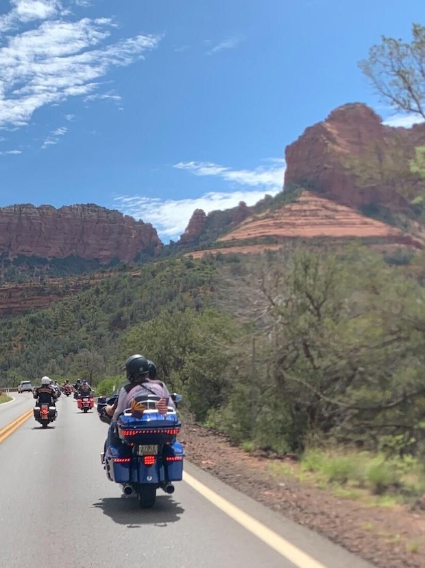
AZ-89A in Sedona
From Cottonwood you’ll start gaining elevation again as you head north on AZ-89A to Sedona. What can I say about Sedona that hasn’t been said a million times before by others? People come from all over the world to experience the hiking and the scenery in Sedona. I think of it as a world-class hiking town in the same way that Aspen is a world-class ski town. From a motorcyclist’s perspective, the red sandstone cliffs and rock formations make it seem as though you are somehow magically riding through the Grand Canyon. You’ll definitely deal with some traffic when heading through the city of Sedona proper, but once you’re north of town and heading up alongside Oak Creek, it will thin out.
You’ll be riding along the floor of Oak Creek Canyon, shaded by trees, with glimpses of cliffs to either side. Eventually the road steepens and begins a series of hairpin turns up the canyon wall to the plateau at nearly 7,000 feet where Flagstaff is located. Savor the turns and the scenery, as the best part of the ride is almost over. Once you get onto the plateau, the road flattens and straightens, and you’re back in a more mundane world, albeit up at elevation enjoying the cooler mountain temperatures.
If my words haven’t convinced you to do this ride, watch this video by Matt Laidlaw of Laidlaw’s Harley-Davidson in southern California. He and his crew do the ride in the southerly direction, from Flagstaff to Wickenburg. The first part of the video is the long ride from the L.A. area just to get to the starting point; the AZ-89A portion starts at the 22:30 mark. Laidlaw and his crew document the ride with multiple cameras and a drone, and do a better job than I ever could. Laidlaw’s enthusiasm for the ride equals my own, and may equal yours, once you give it a try.
Related post: Great motorcycle roads: Hawaii 550/552 Waimea Canyon, Kaua`i
Related post: Great motorcycle roads: The Devil's Highway, US-191 Clifton to Springerville, Arizona
Related post: Great motorcycle roads: Cape Royal Road at the North Rim of Grand Canyon