
|
|
posted: October 4, 2023
tl;dr: The Devil's Highway is quite appropriately named...
These days the Devil’s Highway, also known as the Coronado Trail and US-191, serves one primary purpose: to provide thrills for motorcyclists. US-191 is a north-south road in the southeast part of Arizona, close to the New Mexico border, that connects I-10 in the south with I-40 in the north. Yet I-25, further east in New Mexico, does a much better job of connecting those two interstates, for those whose primary concern is travel time. The 120 mile stretch of the Devil’s Highway from Clifton in the south to the mountain community of Springerville in the north is so twisty that trucks over 40 feet long are banned. There are no gas stations on a 90-mile stretch of it, and extremely poor cellular coverage if you break down. Elevation ranges from 3,400 feet to over 9,300 feet. As a result, very few cars and trucks choose to make the crossing, which leaves it to the enjoyment of motorcyclists.
The Devil’s Highway is appropriately named for several reasons. Of course it is a twisty mountain road, where the Grim Reaper and the Devil can easily claim the souls of riders who don’t treat it with the respect it deserves. It used to be named US Route 666 (the devil’s number) until so many US-666 road signs were stolen that the authorities renumbered the route to US-191. Finally, depending on the direction you ride it, it either starts (northbound) or ends (southbound) in Hell, Hell being the Morenci copper mine, one of the largest copper mines in the world.
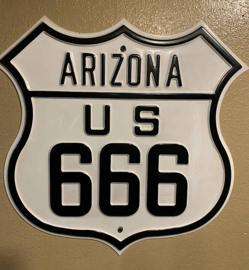
An old highway sign for the Devil's Highway
Pictures cannot capture the immensity of what mankind’s desire for copper and electricity has done to this corner of Arizona. Entire sides of mountains have been scraped off and turned into eroding slopes of loose rock traversed by ramps for the largest dump trucks in the world, which haul rocks and dirt for processing. The road through the mine goes on for miles of this. In the center there is no portion of a 360 degree view of the surrounding mountains that has been left in its natural state: every visible slope has been altered. Other evidence of human activity includes the monster dump trucks, fuel depots, signs warning about blasting, and rock processing equipment with large conveyor belts. Towards the boundaries of the mine you can once again see mountains in their natural state, many of which feature red rock reminiscent of Sedona. But if AZ-89A through Sedona is one of the most scenic motorcycle rides in the country, this portion of the Devil’s Highway is the opposite end of the spectrum. Still, I wish more people could see the mine, to realize that the transition away from fossil fuels comes with tradeoffs.
The twistiest stretch is between the copper mine and Hannagan Meadow. There are more than a few 10mph and 15mph hairpin curves, and you’ll never be going straight for very long. Decreasing radius curves abound, so concentration and skill is required. Unfortunately this means that if you try to enjoy the view, you can easily end up as another one of the Devil’s victims. There are very few places to pull over, stop, and enjoy the view. This is a road for riding.
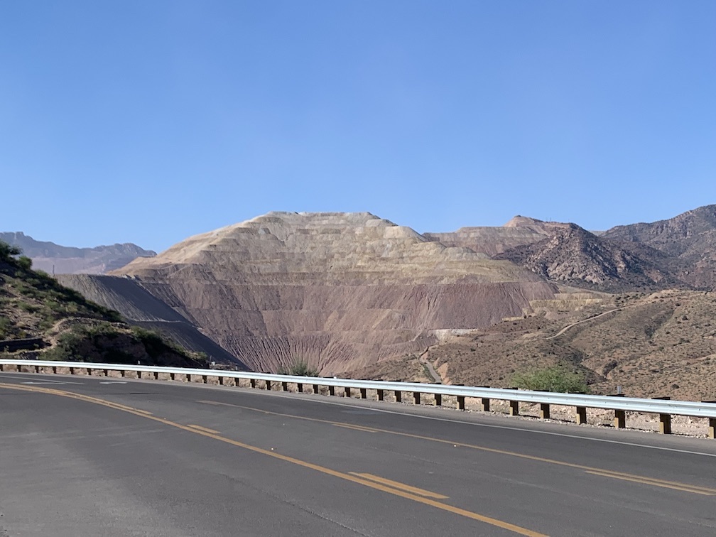
A tiny portion of the Morenci copper mine alongside the Devil's Highway
The road is in decent shape. When I rode it with members of my HOG chapter, fresh oil had been applied in several areas, as denoted by temporary orange signs. They weren’t kidding: the road crew must have just finished for the day when we arrived, as the oil was still in liquid form in many areas, making it slick. I briefly lost traction on one curve but recovered, and was thankful I wasn’t going fast and pushing the limits.
Between Hannagan Meadow and Springerville, which are at elevation, the curves are of the sweeping variety, and can be taken at higher speed. This is actually my favorite type of motorcycle riding, although I do also appreciate the challenge of the tight twisties. There is also plenty of good riding on other two lane mountain roads in the northern area. We rode into New Mexico and visited Alma and the ghost town of Mogollon, which is open for tourists on the weekend. There is so much great riding that I recommend a multi-day trip. The Hannagan Meadow Lodge is motorcycle-friendly and right on the Devil’s Highway, where you can sit on the front porch and watch other motorcyclists enjoying themselves.
Related post: Great motorcycle roads: Arizona 89/89A Wickenburg to Flagstaff
Related post: Great motorcycle roads: Hawaii 550/552 Waimea Canyon, Kaua`i