
|
|
posted: August 6, 2023
tl;dr: It’s a throwback skill, but here are some tips using other modern technology...
Strangely, in this era of ubiquitous GPS navigation systems, I find myself often navigating without GPS. It’s because I ride motorcycles, and when doing so I prefer to keep the distractions to an absolute minimum, for reasons of safety and enjoyment. I don’t have any fancy electronics on my bikes, nor do I have a handlebar mount for my smartphone which would allow me to see the screen while I ride (and therefore take my eyes off the road).
When I lead group motorcycle rides, often many of the riders will be on top-of-the-line Harley-Davidson touring bikes, such as the Street Glide, Road Glide, and Ultra Limited. These bikes have large fairings with built-in audio and GPS navigation systems with touchscreens, similar to modern automobiles. In front, leading this pack of sophisticated bikes, is me on my touchscreen-less, GPS-less, audio system-less motorcycle, which harkens back to a simpler era. Sometimes my fellow riders express amazement that I am able to lead the group on an hours-long ride without making a wrong turn. It’s definitely easier to obediently follow the turn-by-turn instructions from a GPS navigation system, but here are my tips for navigating without one.
Route selection
I’ve written about route selection before, in the context of safety. Choosing a good route also helps with ease of navigation, and fortunately, a safe route is often also an easy to navigate route. If you carefully study the map of an area such as the Valley of the Sun, you can hopefully glean the rules that govern how the street system was set up. Once you know those rules, the good routes become more obvious.
In the case of the Valley of the Sun, many of the streets are in a rectilinear grid with more major streets every fourth street: those are the ones less likely to dead end and require turns to avoid. Yet the rectilinear streets feature many intersections, stop lights or signs, and make it hard to head in a diagonal direction, so they are best avoided if possible. Hopefully you can find a few roads that do not adhere to the rectilinear grid pattern. These often are the original roads built to get from what used to be one small town to another, following whatever path the geography dictated, and only later being overlaid with the grid pattern. Another way to find these original roads is to look at the major divided highways and see if there are nearby roads that roughly follow the same path. This is how the remnants of Route 66 can still be discerned by examining the U.S. interstate highway system.
Choose your route wisely, and you can maximize fun and safety while minimizing turns and navigation difficulty.
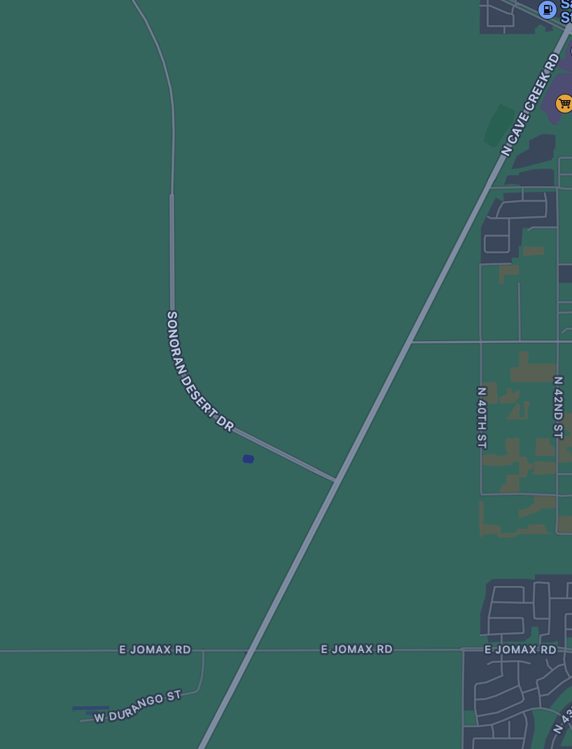
Sonoran Desert Drive is a safe, fun, and easy-to-navigate road
Screenshot all non-obvious turns
I still have my smartphone with me, I just can’t look at it while I am riding. Before the ride I fire up the map app and make screenshots of all the non-obvious turns in order. The screenshots will always be on the phone regardless of cellular coverage: if you rely upon the map app while on your journey, it may fail you. Before the ride I study the turns by flipping between the screenshots, similar to using flash cards as study aids. Then before each leg of the journey I review the screenshots for that leg again.
Pay attention to what precedes each turn
You not only need to know the name of the next road you are turning onto, but you also should know what precedes that turn, either other streets or landmarks. This will allow you to prepare for the turn by getting in the proper lane and slowing down.
This is where I miss GPS navigation the most. The warnings about an upcoming turn are very helpful, and when you don’t have them, you run the risk of shooting past your turn. The other thing that can happen is a growing sense of unease that you may have gone past your turn, if what you are passing does not trigger any recognition. So study what precedes each turn, and get a sense for how long you will be on each road in your journey. If the next turn is an obscure, minor road which could easily be missed, I will use the map app, beforehand, to determine the distance from a major landmark. Then when I pass that landmark I will reset one of my trip odometers and use it to warn me that my turn is approaching.
Forget what you no longer need to remember
Once I complete a leg of the journey, I focus on studying the next leg and I forget the details of what just happened. This way you don’t need to have all the turns memorized for the entire journey, just those for the leg ahead. When I reach my final destination, I breathe a sigh of relief that I managed to make it, without the aid of GPS.
Related post: Bike safety by route selection